Backpacking Loop from Big Sandy to Hailey and Washakie Passes – September, 2022
When you talk to other backpackers about epic hiking, a Wind River Range backpacking trip is always on the list. Part of the Greater Yellowstone Ecosystem, The Winds are a roughly 80-mile mountain range. The mountains run from around Dubois to the north and Atlantic City to the south.
Over the years my wife and I have spent more than 90 nights in the Greater Yellowstone Ecosystem. This includes Yellowstone and Grand Teton National Parks, The Beartooth Wilderness, and four previous trips in the Winds. This region has become special to us, and it’s an area we know well and love deeply.
The primary jumping off location for most trips into the Winds is Pinedale, Wyoming. Pinedale is a small town of around 2000 that is located on the western slopes of the range. In the Summer, Pinedale caters to those who visit the area with hotels, grocery and supplies, and other stops that one might need for their trip.
Total trip mileage for this backpacking adventure was a touch over 36 miles, with more than 5500 feet of elevation gain.
Base Camp
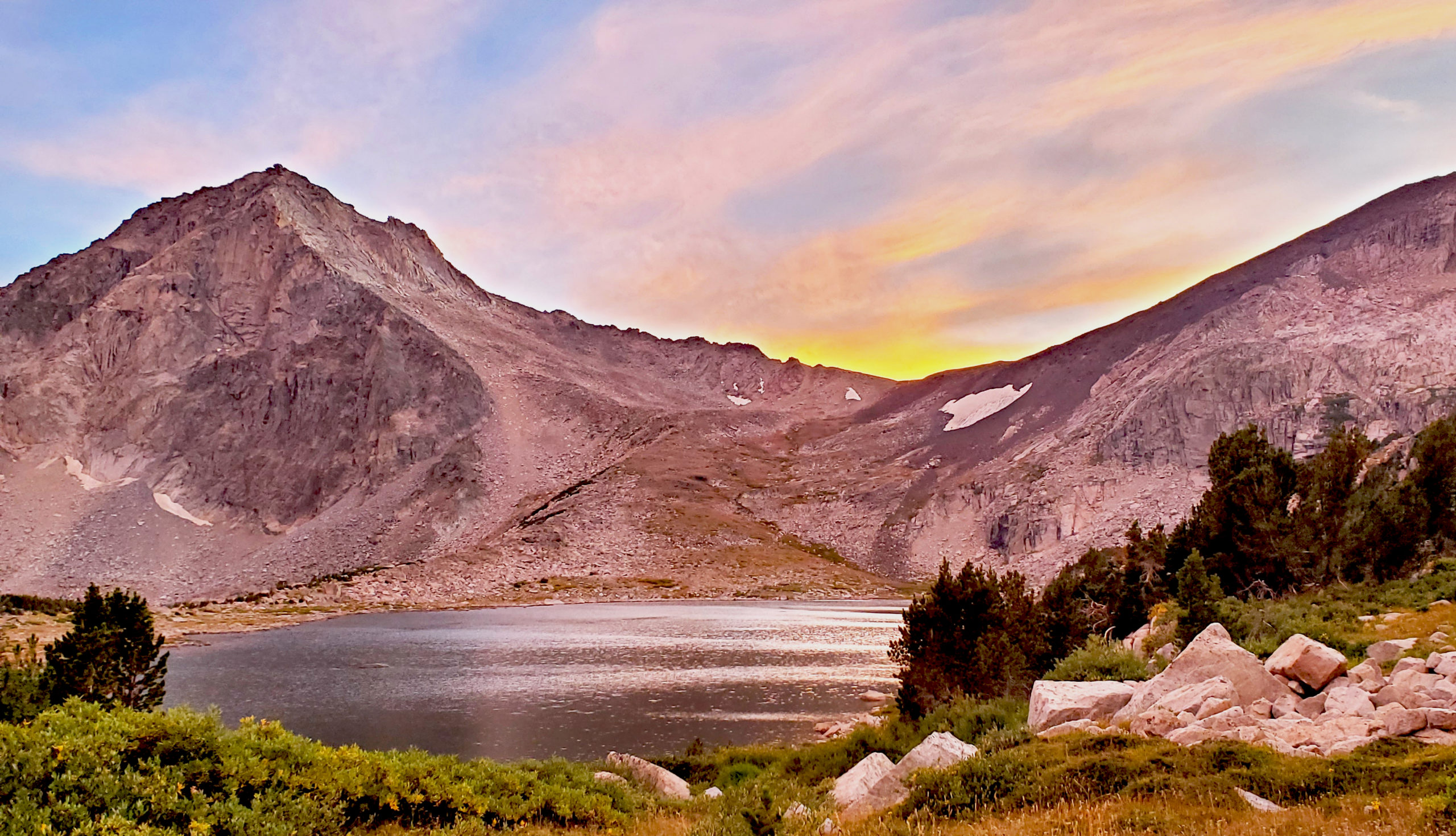
In our case, we opted to avoid the town as we were starting our trip at the Big Sandy Opening, an hour and forty-five minutes from town. Instead, we parked our travel trailer at the Big Sandy West campground before starting our hike. This is a Bureau of Land Management campground that allows for 14 nights of free camping. The campground sits above a lake and has tables and fire rings. When we arrived in mid-afternoon on a Friday, there were a number of sites still available.
The reservoir near the campground was a little low, but that is not surprising for late in the summer. While the afternoon was quite warm, we were pleasantly surprised that it did cool off enough to do a final shake down of our packs at the picnic table before turning in for the night.
We did park the trailer here for the duration of our backpacking trip. There were numerous sites still available both when we left on Saturday and when we made it back. There were no issues as far as vandalism or burglary during this time.
Starting into the Wind River Range
On Saturday, September 3, we set off early from our camp down the long, dusty road to the Big Sandy Opening.
Seriously: Long. Dusty. Road. If you are coming from the south, you will spend an hour and 45 minutes on a dirt road. This track starts in the plains with distant views of the mountains that slowly grow as the miles click by. Eventually you pick your way through old glacial moraines into the forest before arriving at the area of the trailhead.
Big Sandy Opening
The primary parking area of the trailhead was very crowded when we arrived. On previous backpacking trips we were able to easily find a spot not too far from the jumping off point. This time our parking spot was .6 miles from the trailhead, adding to our mileage just a little. We secured our truck and started our Wind River Range backpacking trip, with our destination being somewhere around Marm’s lake with the possibility of pushing further to Skull Lake. The trail is well-marked as this is one of the most popular areas to begin an adventure in the winds.
The Big Sandy opening is the main gateway to the Cirque of the Towers, which is a hike we first did nearly 20 years ago. In those intervening years, it has become increasingly crowded, so we opted for something that is a little more off the beaten path.
Many of the people that we saw were indeed heading for the Cirque. Once we broke off for the trail that is the back half of a popular Cirque loop, the number of people dropped off a bit.
The first part of this hike is largely through a series of meadows separated by some much needed shaded areas of trees. Our first day was warm with a high in the mid-60s, and it was sunny the entire day. Since we were moving well, once we reached Mae’s Lake, we decided to press further to try and reach Skull Lake for our camp.
Break Time
We took a longer break just a little south of the trail intersection with Shadow Lake Trail and saw quite a few people here who were on their downhill side of the Cirque loop. Breaks on longer days (for us) are important, but we also are careful to time them so that a little rest, a little food and a little recovery happens without us getting too stiff. About half an hour or 45 minutes is generally enough to fuel our push for the afternoon. Maybe longer on warm days.
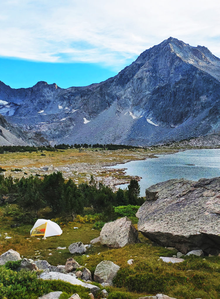
By the time we were making our final push to Skull Lake, I was feeling the miles, the heat, and the altitude. That last mile was the worst of the trip for me and once we arrived at our campsite on the south-western side of the lake, I was spent. The total day was about 10.9 miles with about 1300 feet of elevation gain.
After setting up camp, filtering water, and pre-hanging our bear hang, we sat down at a viewpoint to make dinner and enjoyed a nice rest.
Day 2: Hailey Pass Hike
On Sunday morning, knowing that we had a 11,200-foot pass ahead of us and wanting to make it past before any weather moved in, we were up early. The morning was a decent 45-ish degrees and as the sun made its way above the horizon, we hit the trail for the high mountain air of Hailey pass.
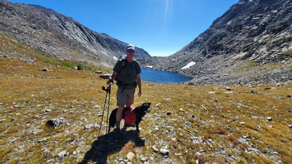
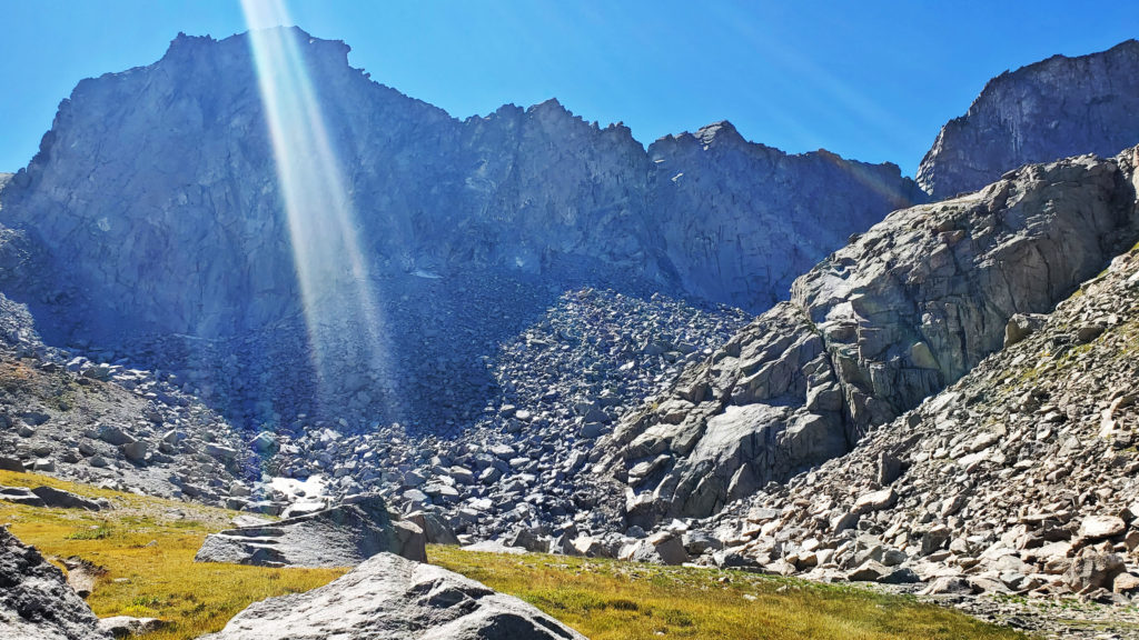
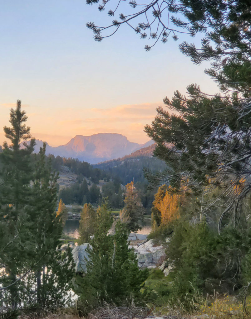
Alpine hiking is a special kind of walking. The open meadows and glacier-polished granite began to dominate the open valley above Skull Lake as we marched towards the 11,200-foot Hailey Pass. The aptly named twin lakes just below the pass provided a welcome location for lunch huddled in the boulders before the final push up and over the saddle before descending steeply down the pass.
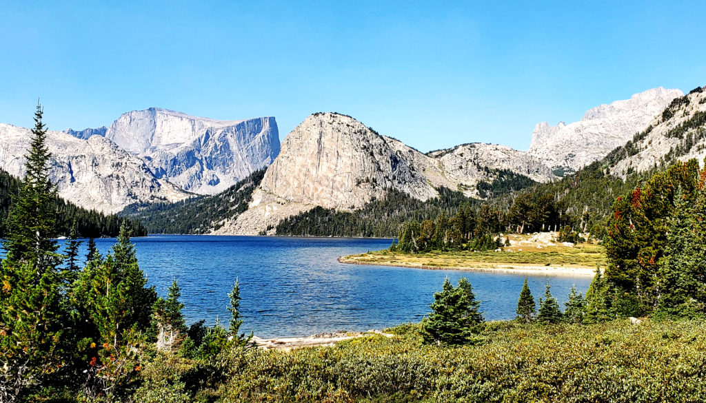
To the west loomed Mt. Hooker, with its 1800-foot north face that was first climbed in 1964 by climbing legend Royal Robins. This 12,509-foot peak kept us looking back throughout the afternoon. This wall (which is way outside this climber’s skill set) is thought to be the hardest alpine wall in Wyoming, with routes that top out around 5.13d. If you find yourself going clockwise on this route, make sure you look back occasionally, to see this amazing wall.
Grave Lake Campsite
After passing a valley with many glacial erratics, we found ourselves once again entering the trees and soon crossed Baptiste Creek near the trail junction for Baptiste Lake and Bears ears Trails. Following the Bears Ears trail further down the valley, we crossed the boulder field of Pilot Knob and walked along the long north shore above Grave Lake.
We began looking for a campsite and were able to locate a nice meadow about 100 yards from the trail that was large enough to set camp and afford enough distance from our tents to make dinner. After dinner we managed a little bit of time to reorganize our gear before settling in for the next day.
Grave Lake to Macon Lake
Day 3 of our Wind River Range backpacking trip was our short day, and our first chance in several days to have a more relaxed morning. After sleeping in a bit and taking our time with breakfast and packing, we headed across the bridge over the outflow of Grave Lake towards our goal for the day: Washakie Lake. With a plan of at least 4.75 miles and 800+ feet of elevation, this was by far our shortest planned day.
Splitting off the Bears Ears trail, we head up the Washakie Pass trail towards the lake and soon begin climbing the hardscrabble track through the trees. Walking through the shade and windbreak of the trees was a welcome break after the open space and wind from the previous day.
This was also the part of the trip when we saw the fewest people, passing only 3 the entire day. Wanting to maintain the solitude, we pushed past Washakie Lake on to Macon lake, making this day about 5.5 miles and around 850 feet of elevation. We found a nice spot in the trees and boulders above the lake before taking care of our camp chores and dinner. This was an amazing sunset location, and we both enjoyed our time above the shore watching the fading light.
Macon Lake to Dad’s Lake over Washakie Pass
Because we were higher, the next morning was a touch cooler, but the sun was still shining bright in the sky warming us as we climbed to Washakie Pass. This was a tougher hike to begin our day, but the reward was the face that, from the top of the pass, we were pretty much headed down hill for the rest of the trip.
This day was a bit less than eight miles, with a net loss of more than 1800 feet from the pass. By the time we made it to our goal of Dad’s Lake, we were spent, and the temperature had climbed into the low 70s, making for a hot day on the trail. We set camp back a bit from the lake shore and found a nice outcrop to make our final dinner.
Final Day of our Backpacking Trip
The 5th day on the trail was a slow start, intentionally as we knew that this was our shortest day of the trip. With only five and a half miles of nearly all downhill hiking, it was going to be a cruiser. We took a little time to hike on our own, which is nice time to reflect on the trip, before making it back to the trailhead, where not surprisingly, there were far fewer cars.
In the intervening years from our first Wind River range backpacking trip in 2002, the popularity of this area has soared. If you are looking for a great time to make this journey, I would recommend considering the shoulder season just after Labor Day as a great alternative, as the crowds seem to dissipate quite a bit after the holiday. For many, a Wind River Range backpacking trip is a bucket-list event, and it is indeed well worth the effort you will need to invest, as the dividends it will repay in memories that will last a lifetime.
Resources:
Windriver.org – All kinds of good info here about the region! This site is from the Wind River Visitor’s Council and branches into the Greater Yellowstone Ecosystem.
AllTrails Map – Our updated map from our trip including accurate campsites.
Leave a Reply